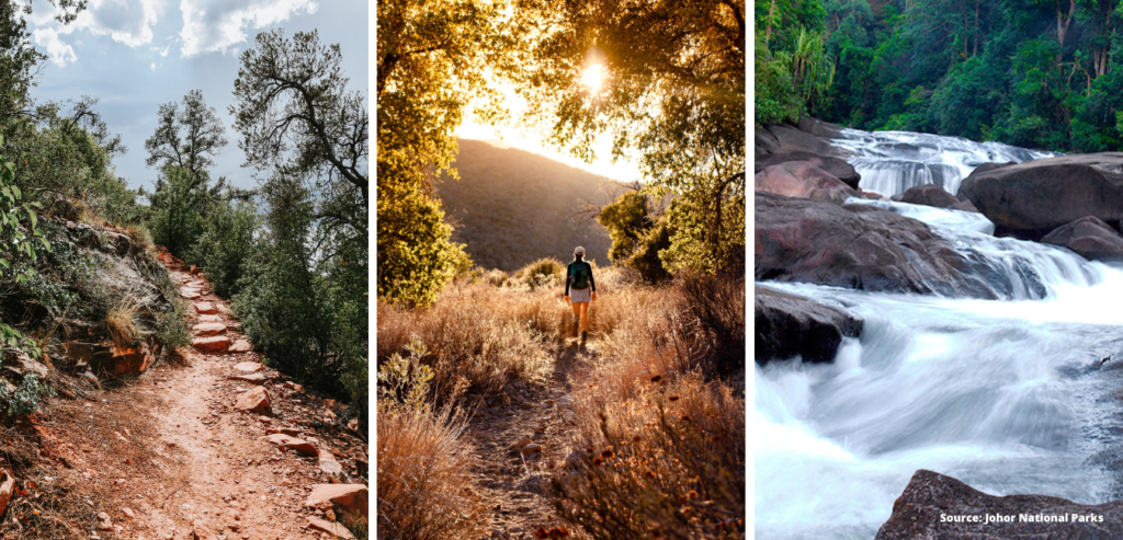
Whenever the weekend hits, a trip to the neighbouring Johor Bahru is a must for some much-needed shopping spree and food hunting trip. But if you’re a truly adventurous soul at heart, a change of scenery can satiate your desire for fresh air and lush nature. Johor Bahru is home to several treacherous mountains and immense national parks which are more strenuous than what we have in Singapore. Think cascading waterfalls, rope climbs and a summit that stands at a staggering height of 1,200m. For those who have reached the top of the Bukit Timah Hill or even Mount Faber, these hiking trails in JB are perfect to test your limit. Whether you’re an adrenaline junkie or prefer easy trekking around Johor, we have curated a list for each and every one of you. So, grab your passport and pack your bag cause we’re going for a hike!
10 Best Hiking Trails In JB
Contents
Bukit Mor
Sequestered at the southeast part of Muar, Bukit Mor is suitable for novice hikers as it features a moderately challenging route with a few steep slopes. The starting point is at the Jalan Pari Jawa and there are several routes that you can take to reach the summit. A scenic panorama view of the black lake awaits hikers at the top of the Mor hill. It is a go-to spot for hiking and running among locals. Prior to hiking, make sure that you snap a picture of the trail map.
| Location | 84150 Parit Jawa, Johor |
| Height | 372m |
| Duration of climb | 2 hours |
| Difficulty level | Moderate |
Bukit Jementah
Bukit Jementah is a 2.9KM trail which takes around more than an hour to complete. It is popular for morning hikes as it offers amazing sunrise views. So if you truly want to bask in the sunshine, make sure to climb it early in the morning. The trail at Bukit Jementah is relatively moderate level and it is suitable for various activities including mountain biking and running.
| Location | Jementah, Johor |
| Height | 180m |
| Duration of climb | 1 hour 7 minutes |
| Difficulty level | Moderate |
Endau Rompin National Park
Endau Rompin National Park boasts 48,905 hectares, making it the second-largest national park in Peninsular Malaysia. This pristine rainforest is home to various wild species including tigers, elephants, tapirs and Sumatran rhinoceros. As its formations date back to over 250 million years ago, visitors can expect lush rainforests with majestic waterfalls. The national park offers a myriad of interesting places such as Buaya Sangkut waterfall, Gunung Besar, Tasik Biru and Upeh Guling waterfall. However, do note that visitors need to apply for a permit for entrance and click here for more details.
| Location | Endau Rompin National Park |
| Height | Varies |
| Duration of climb | Varies |
| Difficulty level | Depending on the trail |
Gunung Pulai
Gunung Pulai is located only an hour and 20 minutes from Singapore, so if you irk the idea of a long drive, it is suitable for you. Touted as one of the best hiking trails in JB, it sits at 654 metres with a moderate to hard route. Visitors can also beat the heat by taking a dip at the stream and waterfalls. The trail takes about four hours in a loop to complete.
| Location | Gunung Pulai Recreational Forest |
| Height | 654m |
| Duration of climb | 2 hours |
| Difficulty level | Moderate – Hard |
Gunung Muntahak
Gunung Muntahak or commonly known as Gunung Tahah by the locals is regarded as one of the top hiking trails in JB. Primarily it was popular due to its stunning Kota Tinggi waterfalls, which require visitors to hike down steep slopes. The trail features seven different sections to the summit with a moderate level of difficulty, thereby it is suitable for beginners as well.
| Location | Gunung Panti Recreational Forest, 81900, Johor |
| Height | 634m |
| Duration of climb | 4 hours |
| Difficulty level | Moderate |
Gunung Ledang
For season hikers, test your limit by climbing Mount Ophir or Gunung Ledang. It sits at a staggering height of 1,276m, earning a spot as the highest mountain in Johor. It takes between six and seven hours to reach the top, but visitors are recommended to camp at the mountain. The trails are challenging with few parts that require the hikers to climb a steep ladder. Once you reach the peak, you can see breathtaking panoramic views and even Malacca city.
| Location | Gunung Ledang National Park, Tangkak, Johor |
| Height | 1,276m |
| Duration of climb | 6 – 7 hours |
| Difficulty level | Hard |
Bukit Belungkor
Our next list of the best hiking trails in JB is not complete without Bukit Belungkor which offers astonishing views of the island. In fact, you can see Pulau Tekong from its summit and even plane takeoff from the Changi Airport. The peak of the Bukit Belungkor features an open space which allows hikers to unwind and observe the panorama. With hiking that takes less than an hour, it is ideal if you prefer an easy trekking trail in Johor.
| Location | Bukit Belungkor Kechil, Kampung Belungkor |
| Height | 190m |
| Duration of climb | Less than 1 hour |
| Difficulty level | Beginner – moderate |
Gunung Lambak
Located at Kluang, Gunung Lambak offers a moderately challenging route that takes four hours to complete. The steep trail features tentacles of tree roots on the ground but rest assured as you can use the assisting ropes provided along the route. If you go during the rainy season, make sure to be extra careful as it can get slippery. Plus, the summit also provides a vertical pole which hikers can scale for aerial view.
| Location | Gunung Lambak, Kluang, Johor |
| Height | 692m |
| Duration of climb | 4 hours |
| Difficulty level | Moderate |
Gunung Belumut
As the name indicates, Gunung Belumut is known for its green mossy forest. Although it’s a sight to behold, it can get quite slippery. This one of the best hiking trails in JB offers a challenging route with steep stairs that hikers need to scale. Aside from the lush greenery, this rainforest is home to various flora and fauna. It is open all year round but it is recommended that you avoid hiking on rainy days.
| Location | Berlumut Mountain Recreational Forest |
| Height | 983m |
| Duration of climb | 5 – 6 hours |
| Difficulty level | Hard |
Gunung Arong
Add Gunung Arong to your weekend itinerary for some serious sweat workout. It features a 6.4KM loop trail which takes about two hours for you to reach the summit. Once you reach the peak, you will be greeted by a majestic view of the South China Sea. There’s also a glass lookout which is not for the faint of heart. Despite its moderate challenging trail, the place is suitable for beginners.
| Location | Gunung Arong Recreational Forest |
| Height | 289m |
| Duration of climb | 2 – 3 hours |
| Difficulty level | Moderate |
For more info make sure to follow Glitz on Instagram and Facebook!